
Source: wirednewyork.com
GENERAL
Structure/Property Name (Current and Original, if Different): Harlem River Drive, Harlem River Speedway
Street Address/Location: 155th Street to Dyckman Street along the Harlem River
Town/City: New York City
County: New York
Owner: New York State Department of Transportation
STRUCTURE/PROPERTY
Architect/Engineer/Other Responsible Parties: Calvert Vaux, landscape architect; J. A. Lockwood, Engineer-in-Charge; Prof. William H. Burr, Consulting Engineer
Historic Use: A flat road for fast-trotting horses and promenade
Present Use: A major thoroughfare
Typology: Park
Architectural Style: Parkway
Period(s) of Construction: 1894-1898
Date of Decommissioning: 1919 – Converted to automobile traffic
Date(s) of Demolition: 1940s to 1960s – Converted to highway
Structural System/Materials: Roadway was formed by packed dirt with a Telford surface at the entrance. Where required by grade, stone retaining walls and stairways were constructed.
Significant Alterations: 1922 – Paved
Brief Architectural Description: Two miles in length, Calvert Vaux’s picturesque Harlem River Speedway had two main entrances with a circular landscaped turnabout at 163rd Street. Southern access was provided at 155th Street at the intersection of St. Nicholas Avenue and Edgecombe Avenue, a place marked by Hooper Fountain and nearly 100 feet above the Harlem River. Gradually declining, the road reached a level of seventeen feet above the high water mark at High Bridge. The lowest point – six feet above the high water mark – was attained at the northern entrance at Dyckman Street. A Telford surface was used for a quarter of a mile at the 155th Street entrance. The remaining road was formed by packed dirt, firm yet elastic – ideal for horse traffic.
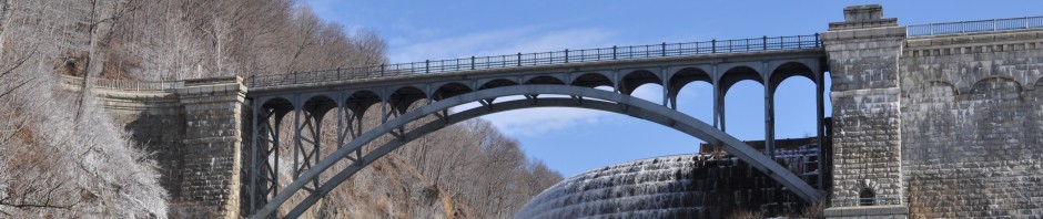
Generally 100 feet in width, the parkway followed the sinewy curve of the Harlem River’s westerly edge. Separated by ten feet of planting spaces, pedestrian walkways flanked the speedway. At High Bridge where the roadway occupied an entire archway, an iron structure wrapped around a pier allowed for a continuous walkway. Pedestrian traffic was prohibited on the parkway, so three tunnels were provided for cross access at the following locations: 163rd Street, High Bridge, and Washington Bridge. Built with dressed limestone walls and carrying an arched granite roof, the subways were twelve feet wide and eight feet high at the crown of the arch.
The easterly walk – generally twenty feet in width – was at the same grade as the road. The western sidewalk, however, rose and fell with the contour of the ground. Stone retaining walls were built into the side of the bluff with elaborate stone stairways, adding to the picturesque appearance of the driveway.
Brief Statement of Historic Significance: In 1893, Calvert Vaux designed a picturesque dirt road – ideal for horse traffic – over two miles in length running along the westerly edge of the Harlem River between 155th Street and Dyckman Street. According to Garden and Forest, his plan “included designs for preserving and enhancing the natural beauties of the water-front and for making them available to pedestrians as well as equestrians.” The Park Board, in a public affront, abandoned Vaux’s design and hired an engineer to plan the roadway. The engineer’s design only provided an inland pedestrian walkway – effectively shielding the public from waterfront access – and no landscaping. Scientific American labeled the design as a “bald and unfinished effect.” Through the efforts of the outraged public, Vaux’s supporters, and organized groups like the Municipal Arts Society, Vaux’s plan was eventually reinstated. Opening in 1899, the Harlem River Speedway became a popular amusement ground for crowds and racers, and was praised by the New York Times as “promoting a sport truly American.” Use of the speedway waned, however, as interest in the automobile grew. The Harlem River Speedway was converted to automobile use in 1919 and paved in 1922.
INTERPRETATION
Accessibility to Public: Harlem River Drive is a main thoroughfare. Fragments and ruins from the speedway era can be seen from the highway.
Landmark Status: None
Threats: The ruins of stairs, retaining walls, and so forth are threatened by neglect.
Current Interpretation: None
Historic Image:

“The Harlem River Speedway, New York,” Harper’s Weekly XLIV:2272 (7 Jul 1900), Contents.
SOURCES:
“A Roadway Built for the Elite to Trot Out Their Rigs,” The New York Times, (13 Jul 1997), R7.
“Autos to Use Speedway,” The New York Times, (4 Dec 1919), 2.
“For a Landscape Architect,” The New York Times, (9 Aug 1894), 9.
“The Harlem Speedway,” Harper’s Weekly, XXXVIII:1971 (29 Sep 1894), 915.
“The Harlem Speedway,” Harper’s Weekly, XLV:2316 (11 May 1901), 492.
“The Harlem River Speedway, New York,” Harper’s Weekly, XLIV:2272 (7 Jul 1900), Contents.
“The Harlem River Speedway, New York,” Scientific American, LXXVI:6 (6 Feb 1897), 89-90.
Kowsky, Francis R., Country, Park, & City: The Architecture and Life of Calvert Vaux, (New York: Oxford University Press, 1898), 315-317.
“Monuments of the Speedway,” The New York Times, (3 Dec 1893), 4.
“Mr. Gilroy’s Speedway Plan,” The New York Times, (13 Jan 1893), 1.
“The New Harlem River Speedway, New York,” Scientific American, LXXI:17 (27 Oct 1894), 257.
“The Parks and the Public,” Harper’s Weekly, XXXVIII:1934 (13 Jan 1894), 44.
Parsons, Mabel, ed., Memories of Samuel Parsons, Landscape Architect of the Department of Public Parks, New York, (New York, London: G. P. Putnam’s Sons, 1926), 43-48.
“Speedway Reopens with New Surface,” The New York Times, (13 Aug 1922), 31.
“Suburban Riding and Driving Club,” Harper’s Bazaar, 29:46 (14 Nov 1896), 946.
“The Speedway,” Harper’s Weekly, XXXVIII:1952 (19 May 1894), 463.
“To Fight for the River Walk,” The New York Times, (26 Oct 1893), 12.
“Two Miles of Speedway,” The New York Tribune, (28 Nov 1897), S5.
FICHE PREPARED BY
Sarah Morrison/ February 27, 2011
